AITELLIGENZ C3

UNIFIED COMMAND, CONTROL &
COMMUNICATIONS (C3) PLATFORM

Command. Coordinate. Protect.

An integrated platform that empowers local governments to monitor incidents, manage resources, and respond faster through real-time data, AI, and seamless communication.

REAL-TIME
MONITORING

Monitor incidents, responders, and city operations in real-time.

AI-POWERED
INSIGHTS

Leverage AI for predictive analytics and smarter decisions.

FAST & EFFICIENT
RESPONSE

Coordinate teams and resources for faster response.

SECURE & SCALABLE
PLATFORM

Built with enterprise-grade security and scalability.

System Capabilities

Explore the specialized modules driving our command center architecture.

AI-Powered Visual Intelligence

The AI-Powered Visual Intelligence module leverages your municipality's existing CCTV infrastructure, transforming passive cameras into active, intelligent sensors. Utilizing state-of-the-art deep learning algorithms, it autonomously monitors city-wide activity in real-time. It can instantly detect anomalies such as large crowd formations, unattended baggage, or perimeter breaches in secure zones. Furthermore, it integrates seamless License Plate Recognition (ALPR) to track suspect vehicles across the city grid, delivering actionable insights directly to the command dashboard without requiring manual human oversight.

  • City-wide Anomaly & Crowd Detection
  • Automated Perimeter Breach Alerts
  • Real-time License Plate Recognition (ALPR)
  • Seamless LGU Dashboard Integration

Advanced Facial & Object Recognition

Our Next-Generation Biometric and Object Classification engine provides unparalleled accuracy in tracking persons or objects of interest across crowded urban environments. When integrated with the central command matrix, operators can upload a reference image, and the system will cross-reference live feeds to map the target's trajectory across the city. It is also trained to identify high-risk items such as drawn weapons or hazardous materials. To ensure public trust, all biometric data is encrypted on-the-fly and strictly adheres to municipal privacy regulations.

  • Person of Interest Tracking
  • Cross-Camera Target Re-identification
  • Weapon & Object Detection
  • Privacy-Preserving Data Encryption

Intelligent Traffic & Mobility Analytics

The Intelligent Traffic & Mobility Analytics module applies advanced machine learning models to intersection cameras, fundamentally optimizing urban flow. Instead of relying on static, timed traffic lights, the system dynamically adjusts signal phasing based on real-time vehicle density and pedestrian movement. It autonomously detects accidents, stalled vehicles, or severe congestion, instantly alerting emergency services and rerouting digital signage to divert traffic. It also tracks moving violations, enabling automated, unbiased ticketing for infractions like running red lights or illegal turns.

  • Real-time Congestion Mapping
  • Autonomous Accident Detection
  • Smart Traffic Light Optimization
  • Violator Tracking & Automated Ticketing

Autonomous Disaster & Environmental Telemetry

A unified, preemptive system designed to protect citizens from natural disasters before they strike. This module synthesizes complex data streams from meteorological Doppler radar, topographical flood sensors, and seismic monitors into a single predictive model. By tracking real-time water levels and soil saturation, it can forecast flood risks and automatically trigger multi-channel evacuation warnings to affected districts. In the event of an earthquake, it rapidly models structural integrity risks across critical infrastructure, prioritizing areas for immediate search and rescue deployment.

  • Predictive Flood & Water Level Tracking
  • Seismic Structural Integrity Modeling
  • Extreme Weather Doppler Integration
  • Automated Multi-Channel Evacuation Routing

Intelligent Command & Autonomous Dispatch

At the core of the AITELLIGENZ platform is the Intelligent Command & Autonomous Dispatch module, which revolutionizes emergency response times. Using Natural Language Processing (NLP), the system automatically ingests, triages, and prioritizes incoming emergency reports from multi-channel sources (calls, texts, app alerts). It evaluates the severity of the incident, cross-references live fleet locations, and dispatches the closest, most appropriate first responder units. The system provides responders with automated turn-by-turn routing, bypassing detected traffic anomalies for the fastest possible arrival.

  • Multi-Channel Report Ingestion
  • AI Triage & Emergency Prioritization
  • Live Fleet Location Tracking
  • Automated Turn-by-Turn Routing

HOW IT WORKS

FROM DATA TO RAPID RESPONSE
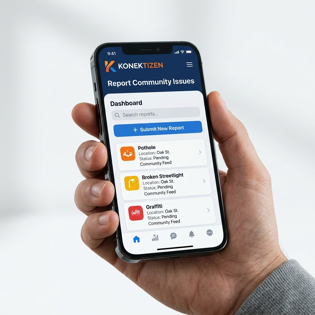
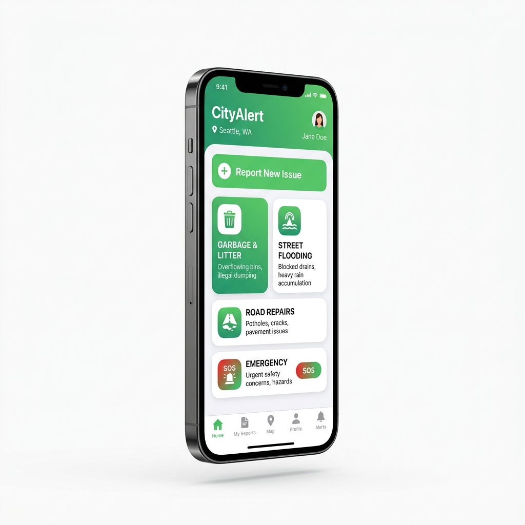
Konektizen

KONEKTIZEN

Citizen-driven issue reporting and direct community-to-command communication.
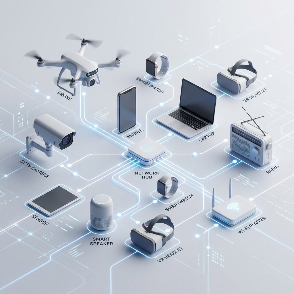
Assets

ASSETS

Real-time data and communications input from connected devices and systems.
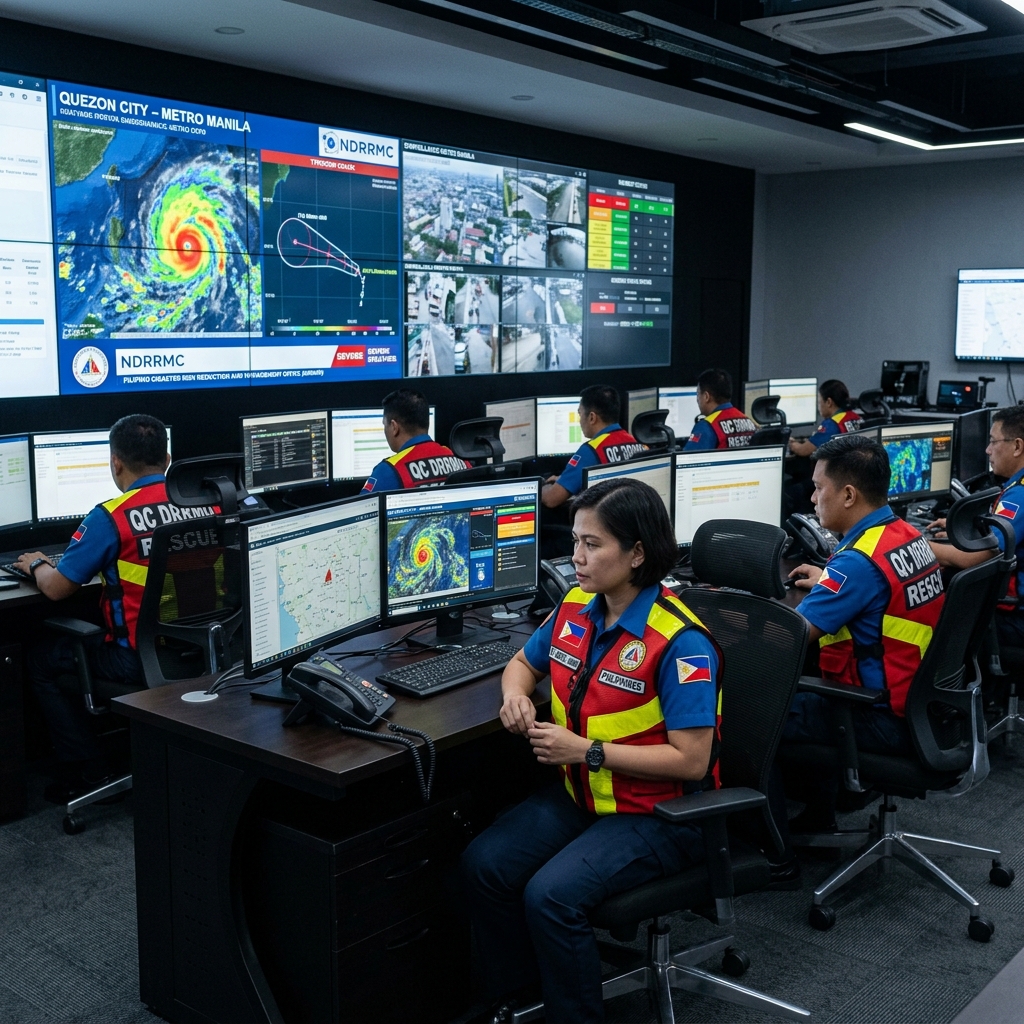
C3 Command Center

C3 COMMAND CENTER

Dispatch, monitor, analyze, and send real-time updates and instructions.
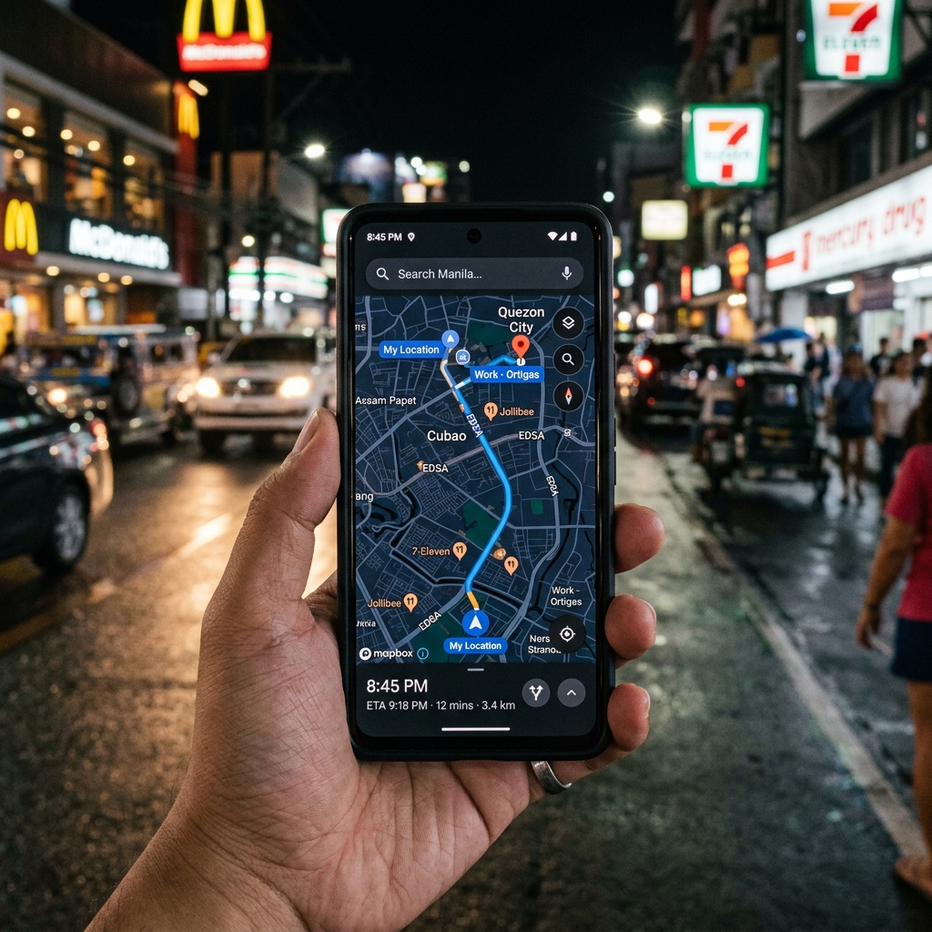
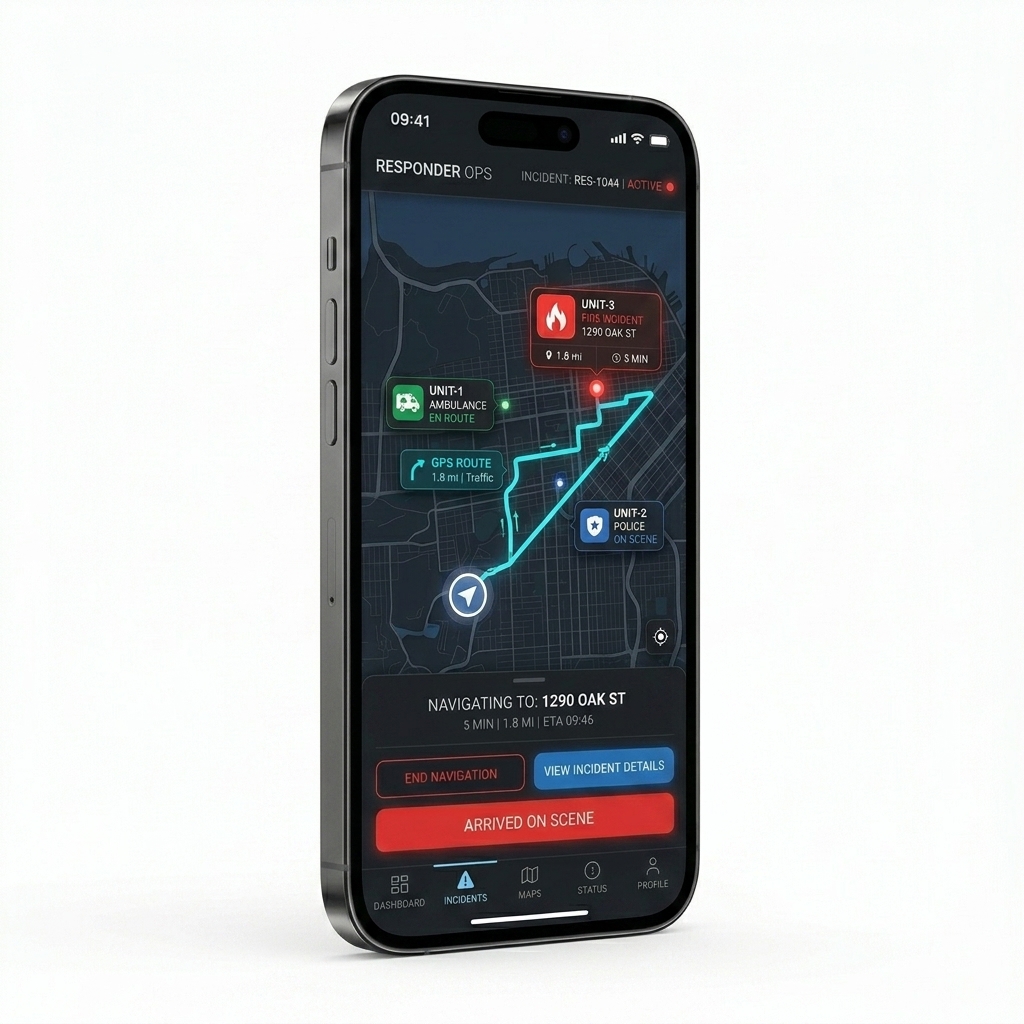
Responders App

RESPONDERS APP

Receive alerts, navigate, communicate, and update status in real-time.
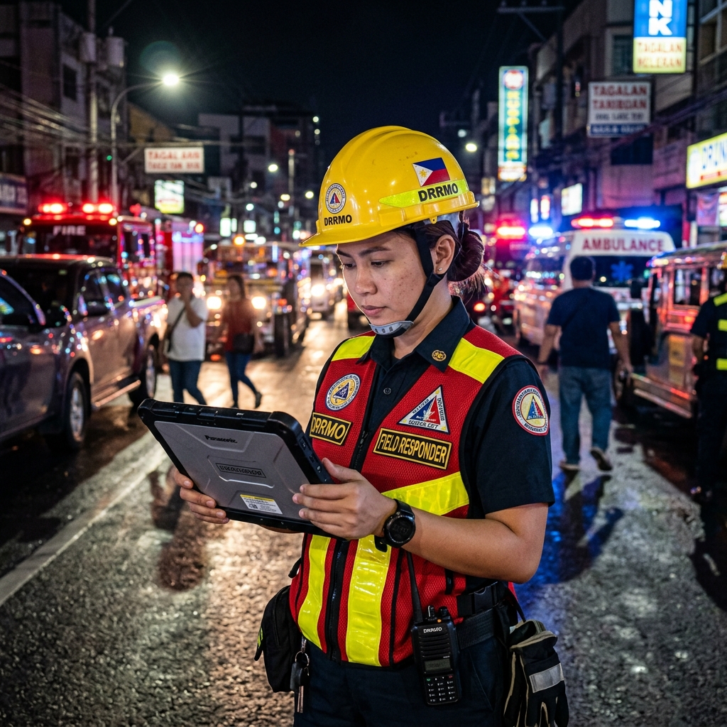
Field Response

FIELD RESPONSE

Take action and resolve incidents on-site for a safer community.

Platform Features

POWERFUL CAPABILITIES FOR SMARTER OPERATIONS

Real-Time Monitoring Dashboard

Centralized dashboard for monitoring incidents, responders, and city operations in real time.

AI Assistant (AIGOR)

Provides real-time support and insights through intelligent conversations for faster, informed decisions.

Live Maps & GIS Mapping

Interactive map visualization and real-time tracking of incidents, assets, and responder locations.

Unified Asset Management

Manage vehicles, CCTV, IoT devices, radios, and other assets in one integrated system.

Integrated Radio Communications

Seamlessly connects analog, DMR, and Radio-over-IP systems for reliable voice communication.

Launch Console

Incident Management & Dispatch

Centralizes reporting, tracking, and resolution of incidents for faster coordination.

Konektizen App

KONEKTIZEN APP

CONNECTING CITIZENS TO FASTER RESPONSE

A citizen reporting app that connects communities with local government services. Residents can report issues like garbage, flooding, road damage, and more—with photos and location details sent directly to the C3 Command Center.

  • AI-assisted issue reporting
  • Quick-report categories
  • Photo & GPS location submission
  • Real-time report tracking
  • Command Center integration

C3 RESPONDERS APP

SMARTER TOOLS FOR RESPONDERS IN THE FIELD

A mobile app for emergency teams that delivers real-time alerts, navigation, and updates from the C3 Command Center to support faster response in the field.

  • Real-time incident alerts
  • GPS navigation and routing
  • Responder location tracking
  • Command Center synchronization
  • Live incident information
C3 Responders App

BUILT FOR A SAFER AND SMARTER COMMUNITY

FASTER RESPONSE

Reduce response time with real-time data and alerts.

BETTER DECISIONS

AI-driven insights and analytics for smarter planning.

IMPROVED SAFETY

Protect lives and property with pro-active monitoring.

STRONGER COMMUNITIES

Build trust through transparency and effective service.